From Buckingham Palace to Tower Bridge: Big Ben, the London Eye, St Paul's and the Shard as real Minecraft worlds, built from map data at real scale. Fly the streets, explore the map, then make any part of it on your phone.
By the BlockMap teamPublished 29 October 2026World made 29 October 2026
In the app: A 5 km map · 1 km per app searchBedrock and JavaDefault look
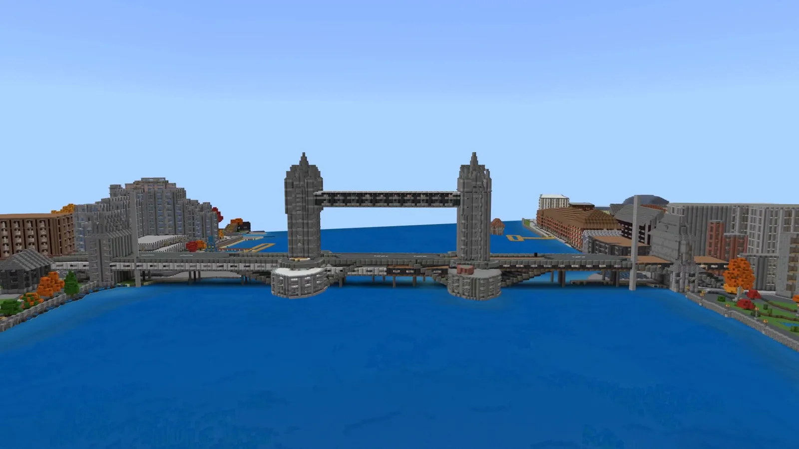
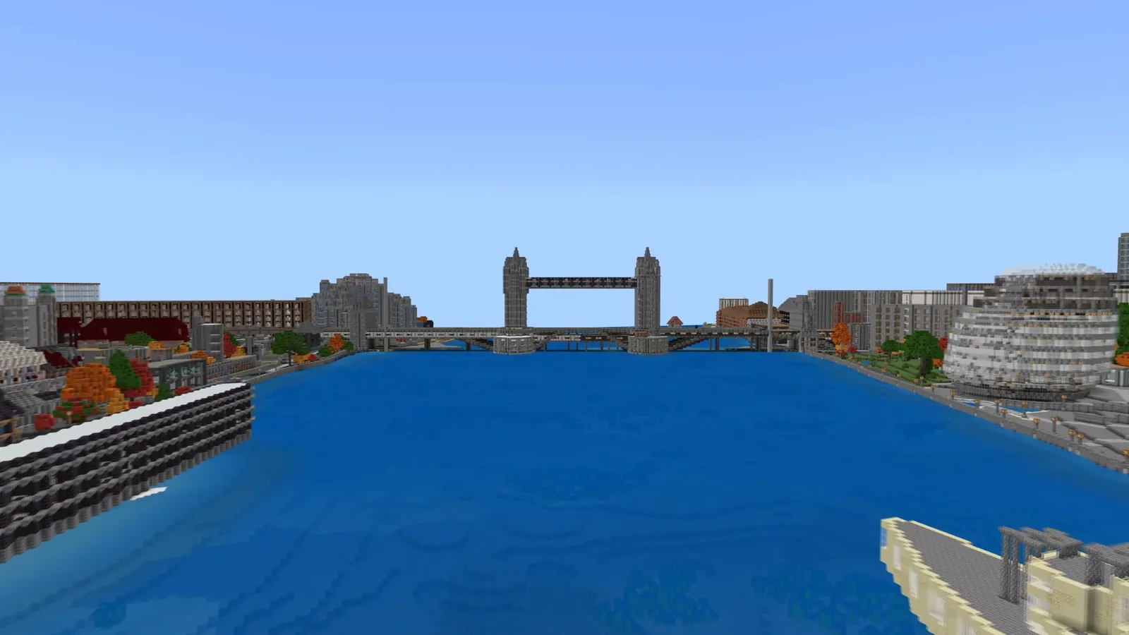
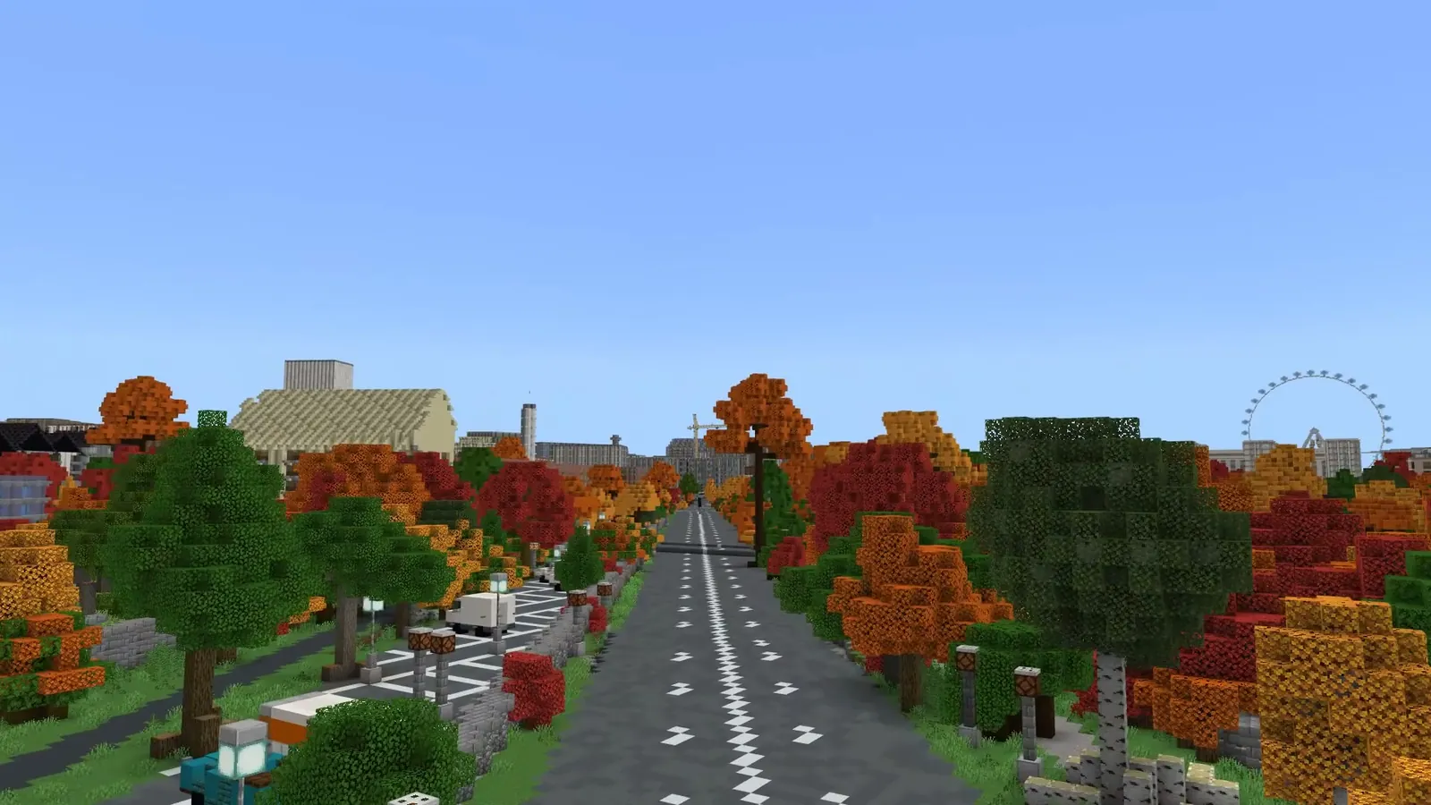
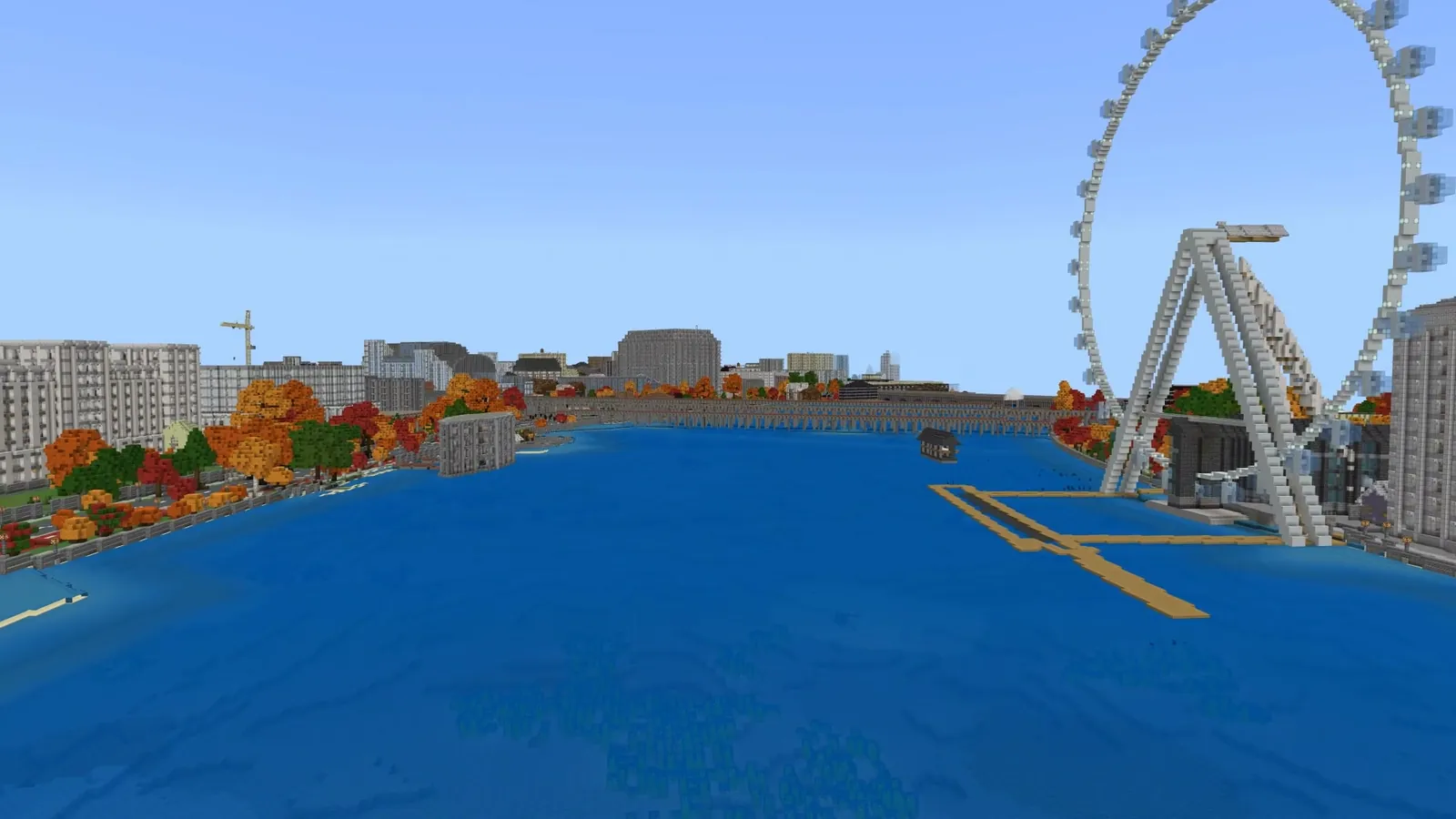
Down the Thames past London Bridge and the Shard to Tower Bridge. Default look, filmed in October, when the app gives trees their autumn colours.
Map of this world
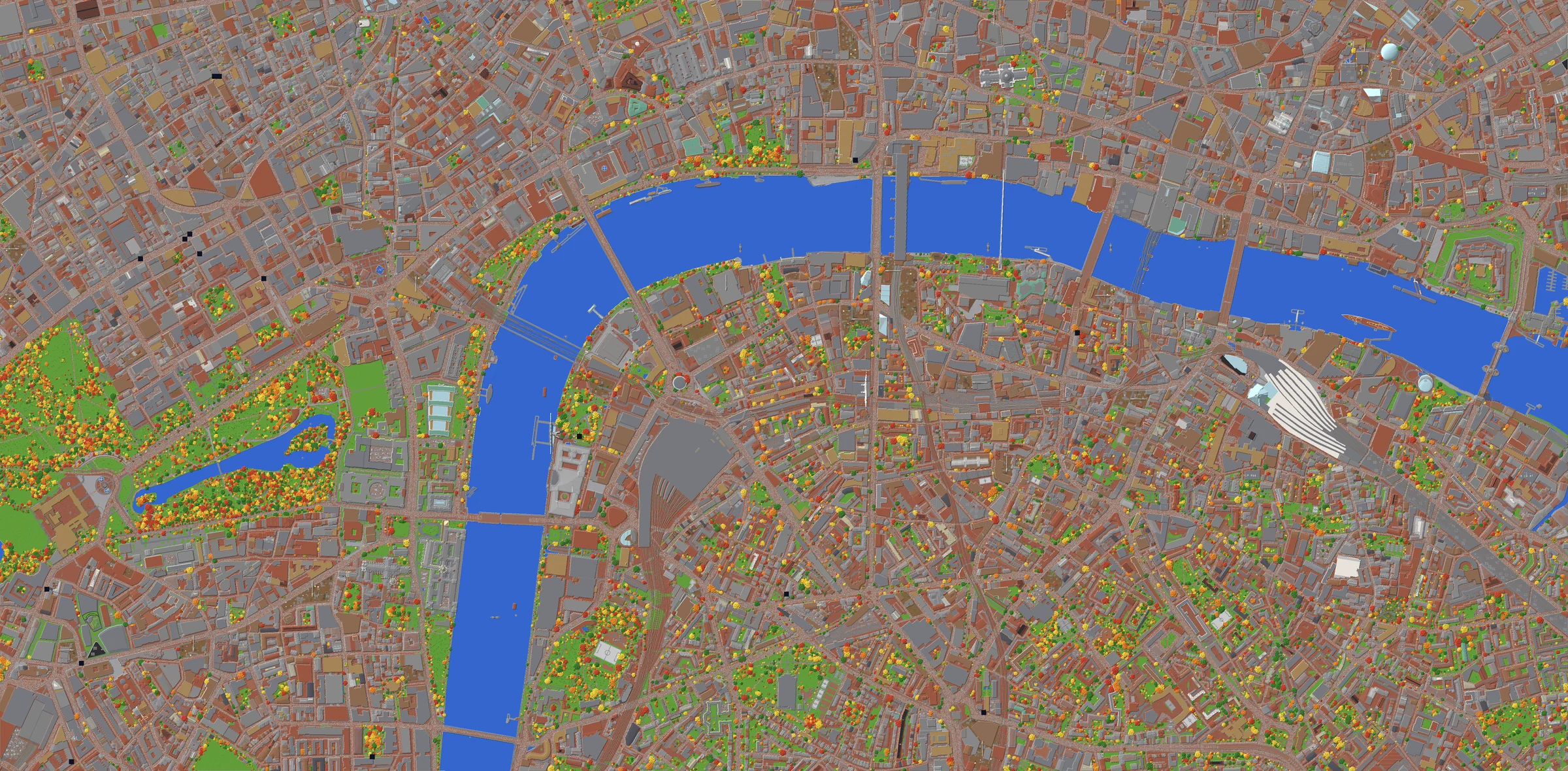
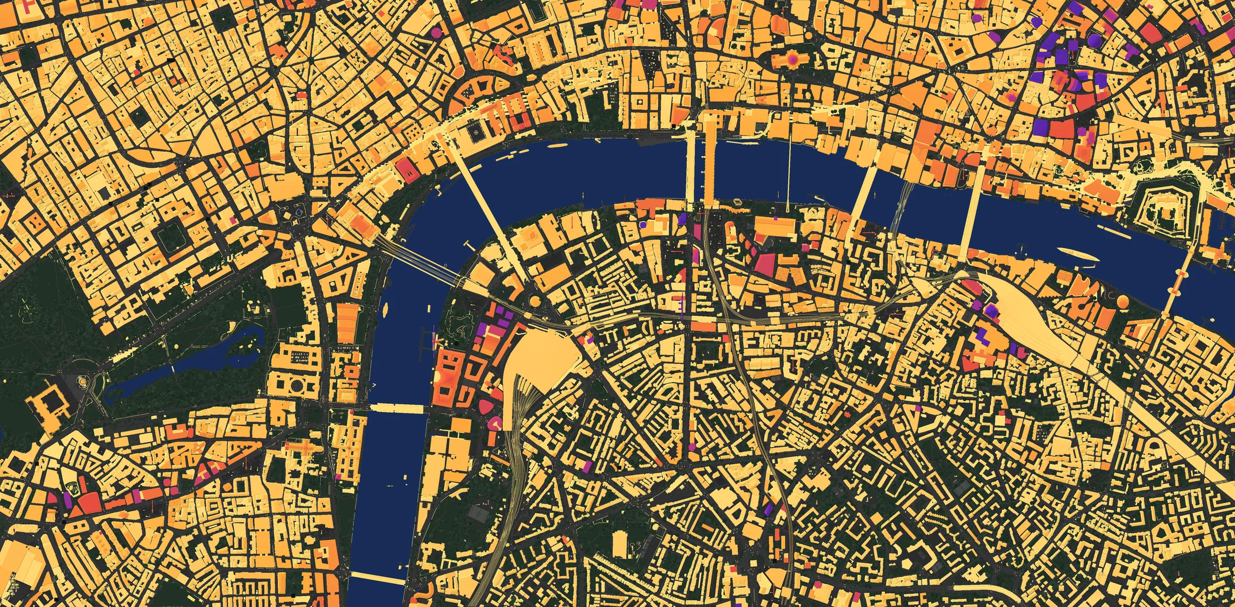
London from straight above, drawn block by block from the world itself: 5 km of the Thames from Buckingham Palace to Tower Bridge, north up. Switch on the layers to see the camera paths, the heights of every building, the tallest towers and what one search in the app builds.
Zoom with + or a double-click, drag to move. Hover the map to read what is there and how tall it is; switch on Camera paths and click one to play its video.
Buckingham Palace on the left, the City and Tower Bridge on the right. The world the app builds for one search is a 1 km square: switch on App searches to see five of them.
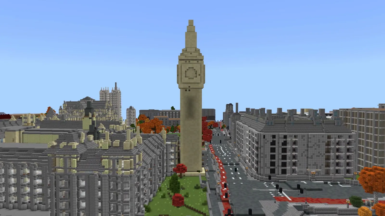
The Elizabeth Tower stands 97 blocks from the street to the top of its spire, with the Palace of Westminster running south along the river to Victoria Tower.
OpenStreetMap maps Westminster in 3D, so the towers, roofs and colours come through in the blocks instead of plain boxes.
In the app:
2St Paul's Cathedral
0:18
Round St Paul's Cathedral
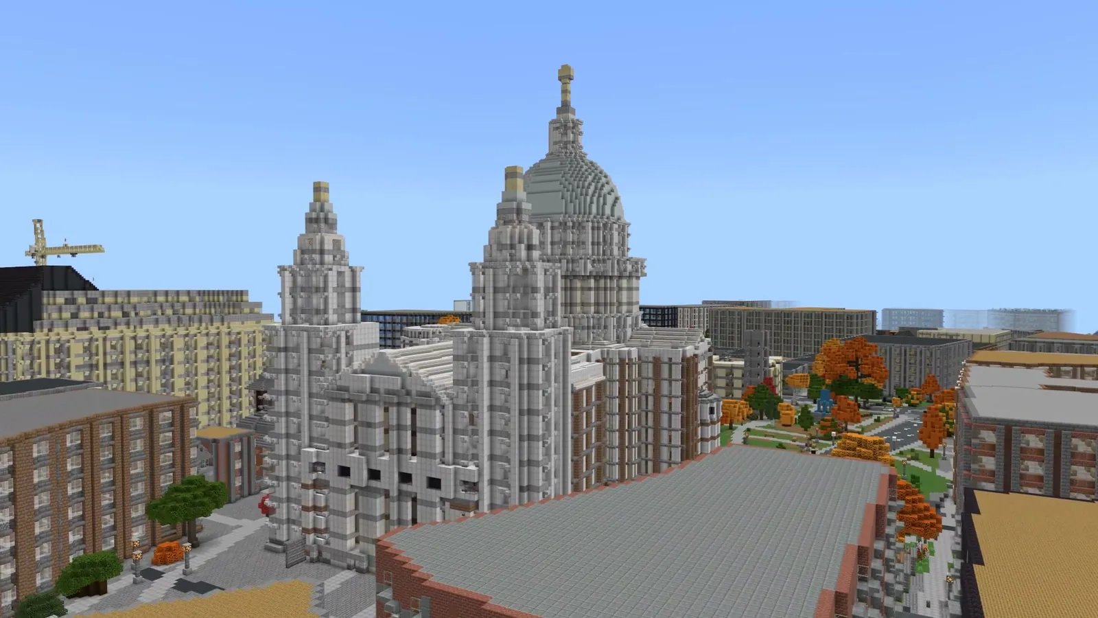
The cathedral sits at the top of Ludgate Hill with its dome over the rooftops of the City and its two west towers facing Fleet Street.
Fly up Ludgate Hill to its steps in the flyovers below, or cross the river and look back at it from Bankside.
In the app:
3Tower Bridge and the Tower of London
0:18
Round Tower Bridge, the Tower of London behind it
The bridge's two towers and walkways span the river at the east end of this map, with the Tower of London's walls on the north bank beside it.
The river flyover below ends here, coming round the bend from London Bridge with the Shard on the right.
In the app:
4Buckingham Palace
0:18
Round Buckingham Palace and the Victoria Memorial
The palace stands at the west end of The Mall with the Victoria Memorial in front of it, Green Park to the north and St James's Park, with its lake, to the east.
From here The Mall runs straight for almost a kilometre to Admiralty Arch: one of the flyovers below follows it.
In the app:
5Trafalgar Square and Nelson's Column
0:18
Round Nelson's Column in Trafalgar Square
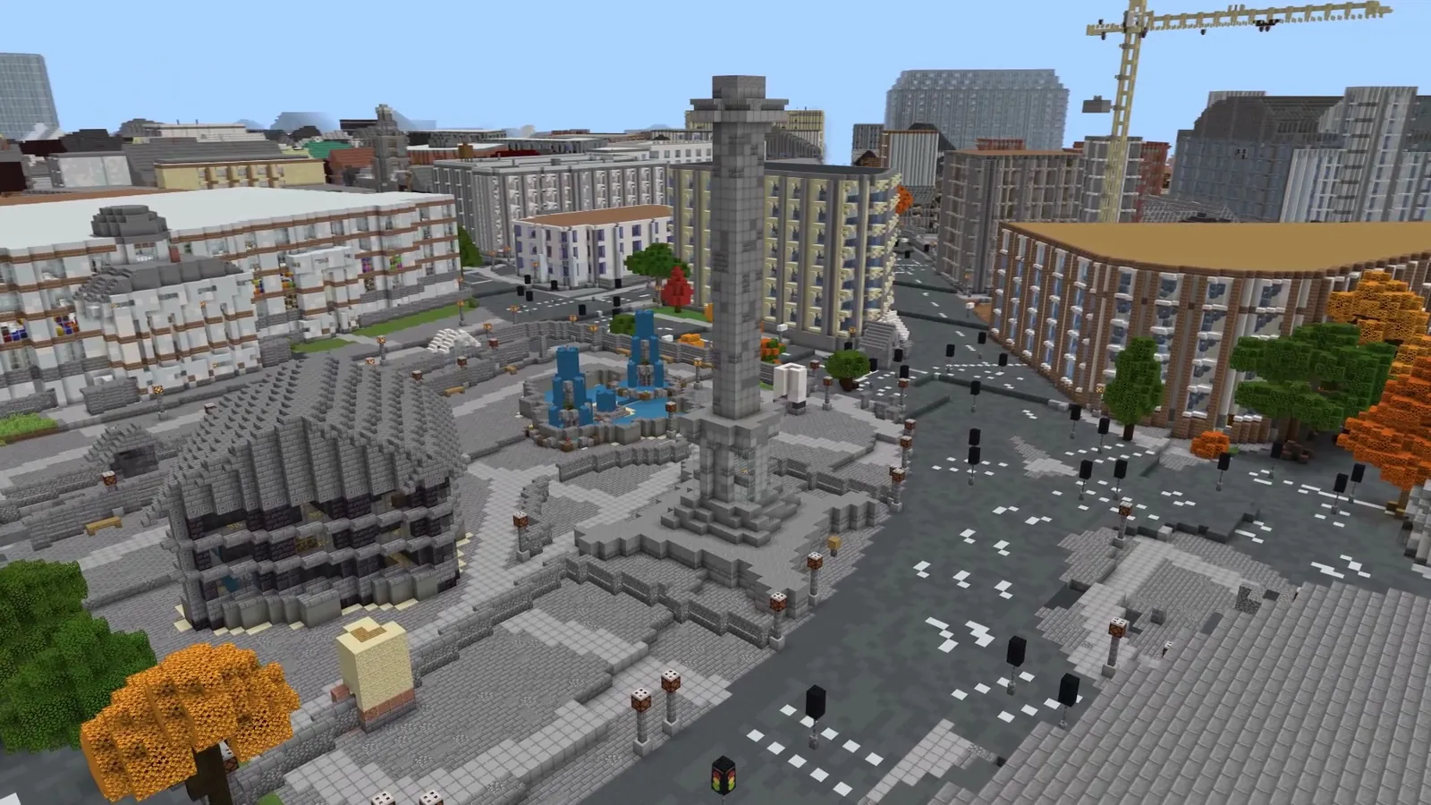
Nelson's Column rises 52 blocks over the square, its real height, with Admiralty Arch to the south-west and Whitehall leading south towards Parliament.
The square is where The Mall, Whitehall and the Strand meet, so it is a good place to start exploring on foot.
In the app:
6The London Eye
0:18
Round the London Eye from across the Thames
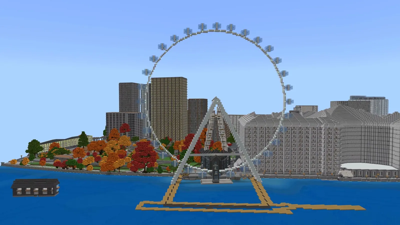
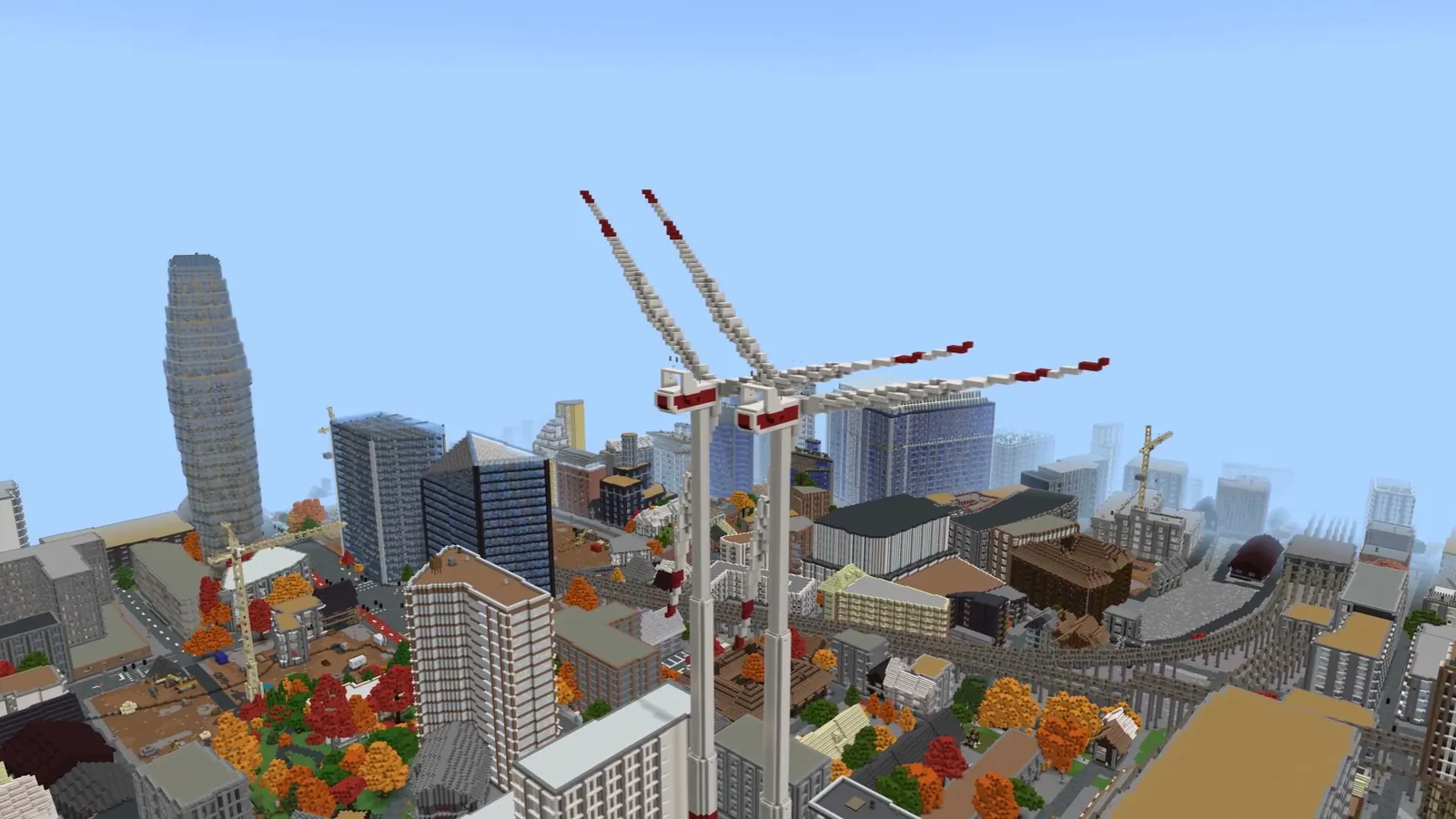
The wheel stands 134 blocks tall on the South Bank. BlockMap builds big wheels as real wheels, with a rim, spokes and capsules.
Beside it, the old County Hall has a hall of tables and chairs on its ground floor, one of the building interiors the app adds.
In the app:
7The Shard
0:18
Round the Shard
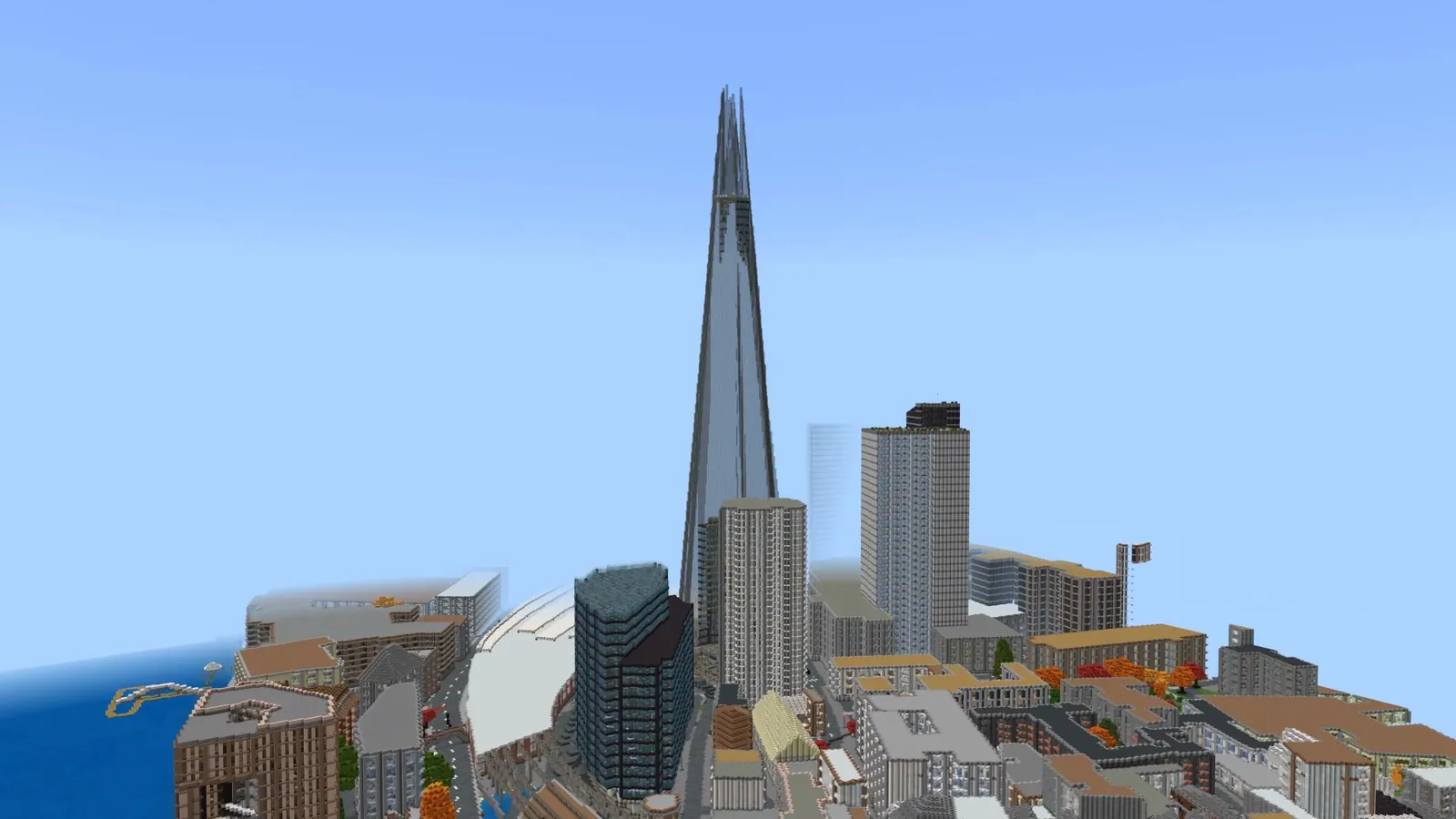
The tallest thing in this world: 312 blocks above the streets around it, close to the real tower's 310 metres, and still under Minecraft's height limit, so the whole spire fits.
It stands by London Bridge station on the south bank, looking across the river at the towers of the City.
8The City of London
0:18
High over the Thames: St Paul's, the City towers and the Shard
The cluster of towers in the Square Mile: 22 Bishopsgate at 288 blocks, the Leadenhall Building at 233, Tower 42 and 30 St Mary Axe, the Gherkin, all measured in this world.
Switch on Tallest on the map above to find each of them, or Heights to see how the City rises out of the low streets around it.
Flyovers along the streets and the river
Straight runs at about third-floor height along London's long streets, and three legs down the Thames at roof height. Each one follows the real street or the river's centre line from OpenStreetMap.
These are filmed in the 5 km world on this page. In the app, one search builds 1 km, so search the places named under each flyover to get its part of the route.
0:24
StartThe skyline along the way: up to 16 blocks715 m
The Mall
720 mBuckingham Palace → Admiralty Arch
The ceremonial avenue from the palace to Admiralty Arch, dead straight and lined with trees, with St James's Park along its south side.
In the app:
0:23
StartThe skyline along the way: up to 36 blocks546 m
Whitehall
550 mTrafalgar Square → Parliament Square
Past the government buildings and Horse Guards, with Big Ben growing at the end of the street.
In the app:
0:20
StartThe skyline along the way: up to 42 blocks491 m
Fleet Street and Ludgate Hill
490 mFleet Street → St Paul's
Up the hill towards the west front of St Paul's, its dome filling the view.
In the app:
0:38
StartThe skyline along the way: up to 135 blocks1299 m
The Thames at Westminster
1.3 kmLambeth → Hungerford Bridge
Along the river past the Houses of Parliament, over Westminster Bridge and past the London Eye.
In the app:
0:40
StartThe skyline along the way: up to 102 blocks1528 m
The Thames to Blackfriars
1.5 kmWaterloo Bridge → Blackfriars
Round the bend past Somerset House and the Embankment towards Blackfriars, with St Paul's ahead on the left.
In the app:
0:31
StartThe skyline along the way: up to 78 blocks1063 m
The Thames to Tower Bridge
1.1 kmSouthwark → Tower Bridge
Past London Bridge, with the Shard on the right and the City towers on the left, to Tower Bridge.
In the app:
Pictures and more video
0:18
Over the Thames at Westminster: Big Ben, the bridge and the London Eye
London's tallest, measured in this world
Measured from the blocks: each structure's height above the ground around it. Names come from OpenStreetMap, where a building with a matching mapped height stands there; 4 more of the ten tallest have no name in the map data and are marked on the map only.
#
Structure
Height
1
The Shard
312 blocks
2
22 Bishopsgate Tower
288 blocks
3
The Leadenhall Building
233 blocks
4
Tower 42
193 blocks
5
30 St Mary Axe
182 blocks
6
One Blackfriars Tower
167 blocks
London by the numbers
Measured from the world file itself, block by block.
312blocks: the Shard, the tallest thing in this world
52blocks: Nelson's Column
5.1 kmof London, Buckingham Palace to Tower Bridge
The top block of every column in the world, by material.
Concrete (roads, pavements)12.6%
Stone bricks10.2%
Water9.5%
Stairs (roof edges)8.4%
Terracotta (roofs, walls)8.2%
Concrete powder7.4%
Smooth stone6%
Andesite3.4%
Everything else34.3%
About this London map
This is central London as the BlockMap app builds it: streets, building outlines, parks and the river where they are in the real city, from OpenStreetMap data, and every building at its mapped height, so the Shard rises 312 blocks and Big Ben 97.
Central London is one of the best-mapped places in the world, which is why the worlds here are so detailed: Westminster's palace and towers are mapped part by part, and the City's skyscrapers carry their real heights.
In the app you get 1 km around each search. Search Buckingham Palace, Trafalgar Square, Westminster Bridge, St Paul's Cathedral or Tower Bridge, or your own street, and change the look first if you like: snow, a golden-hour sky, a flood or a storm.
How we made this page
Everything on this page was built by the same engine and map data as the app. Each search in the app builds about 1 km around the place you pick: switch on App searches on the map to see the worlds for Buckingham Palace, Trafalgar Square, Westminster Bridge, St Paul's Cathedral and Tower Bridge. The Big Ben and London Eye videos come from the app's own Westminster Bridge world, made on 24 October 2026.
For the overhead map, the street and river flyovers and the other landmarks we built the whole stretch from Buckingham Palace to Tower Bridge in one piece, 5.1 by 2.5 km, on 29 October 2026, with the same engine and settings. It took 194 seconds on our servers and came out as a 103 MB world. The app itself builds 1 km at a time.
We filmed both worlds in Minecraft Bedrock Edition with a scripted camera that flies planned paths at street and river level. Nothing in the worlds was changed for the camera. The map, the heights, the tallest list and the numbers are measured from the big world's blocks; a tower is named only where a building mapped in OpenStreetMap with a matching height stands there.
Map data comes from OpenStreetMap contributors, with building data from the Overture Maps Foundation, land cover from ESA WorldCover, tree canopy from Meta and WRI, and elevation from the GEDTM30 terrain model. Worlds are built by the open-source Arnis engine.
Questions
How do I download this London Minecraft map?
Install BlockMap on your phone, search one of the places on this page, for example Westminster Bridge for Big Ben and the London Eye, and tap Create. About a minute later the app opens the world in Minecraft, or gives you a download link for Java. Each search builds about 1 km; your first world is free.
Can the app build all of this at once?
No. One search builds about 1 km around the place you pick. The 5 km map on this page was built in one piece with the same engine to show the whole stretch; search each place to get its part on your phone.
Which searches give me these places?
Buckingham Palace, Trafalgar Square, Westminster Bridge (Big Ben, Parliament and the London Eye), St Paul's Cathedral and Tower Bridge. Searching Big Ben on its own can bring up other places with the same name first.
Is the Shard full height?
Yes. It stands 312 blocks above the streets around it, under Minecraft's height limit, so the whole tower fits.
Does this London map work in Minecraft PE on my phone?
Yes. Minecraft PE (Pocket Edition) is now called Bedrock Edition, the Minecraft on phones and tablets. The app opens the world in Minecraft with one tap, and it appears in your worlds list.
Can I play these London maps on a PC with Java Edition?
Yes. Choose Java in the app before you create the world, open the world's download link on your PC and unzip it into your saves folder. Java worlds need Minecraft Java 1.21.4 or newer.
Is it free?
Your first world is free. After that you can make a free world every 8 hours, or subscribe for unlimited worlds.
 BlockMap